
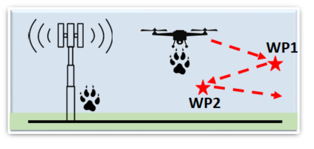
This experiment mode will be an extension of Scenario 3 (F2AM) by allowing trajectory control for the drones using pre-defined way-points, as illustrated in the adjacent figure. AERPAW will offer a library of pre-configured trajectories to the experimenter, while the experimenter can also define their own waypoints, with the restriction that they should be within the boundaries of the flight area. The drone will not be allowed to fly outside of a pre-defined geofence.
In this experiment, the drone carrying PAW can sense the signals radiated from nearby equipment while being flown in the predefined trajectory, or it may directly communicate with the ground PAW. IoT sensors buried under the ground can also play the role of equipment. Several related experiment classes are illustrated below, where different optimization criteria can be used to optimize a drone’s pre-defined trajectory. Drones following predefined trajectories have been also considered in some recent literature, which uses techniques such as dynamic programming, to find an optimal path under the considered criteria. For example, the goal can be to minimize flight time, maximize coverage to ground users, or maximize energy efficiency. The optimal UAV path can be obtained by means of various offline based methods such as graph theory, convex optimization, dynamic programming, or heuristics methods.
Signal Measurement during Flight
| [1] R. Amorim, H. Nguyen, P. Mogensen, I. Z. Kovacs, J. Wigard, and T. B. Sørensen, “Radio channel modeling for UAV communication over cellular networks,” IEEE Wireless Commun. Lett., vol. 6, no. 4, pp. 514– 517, 2017. |
| [2] Qualcomm, “LTE Unmanned Aircraft Systems,” May 2017. [Online]. Available: https://www.qualcomm.com/media/documents/files/lteunmanned-aircraft-systems-trial-report.pdf |
| [3] R. Amorim, P. Mogensen, T. Sorensen, I. Z. Kovacs, and J. Wigard, “Pathloss measurements and modeling for UAVs connected to cellular networks,” in Proc. IEEE Veh. Technol. Conf., 2017, pp. 1–6. |
| [4] R. Muzaffar, C. Raffelsberger, A. Fakhreddine, J. L. Luque, D. Emini, and C. Bettstetter, “First experiments with a 5G-connected drone,” in Proc. ACM Workshop on Micro Aerial Vehicle Networks, Systems, and Applications, ser. DroNet ’20. New York, NY, USA: Association for Computing Machinery, 2020. [Online]. Available: https://doi.org/10.1145/3396864.3400304 |
Estimate Drone Locations
| [1]O. D. Mora Granillo and Z. Zamudio Beltran, “Real-time drone UAV trajectory generation and tracking by optical flow,” in Proc. Int. Conf. Mechatronics, Electronics and Automotive Engineering (ICMEAE), 2018, pp. 38–43. |
| [2] L. V. Santana, A. S. Brandao, M. Sarcinelli-Filho, and R. Carelli, “A trajectory tracking and 3D positioning controller for the ar. drone quadrotor,” in 2014 Int. Conf. on Unmanned Aircraft Systems (ICUAS), 2014, pp. 756–767. |
| [3] M. Gowda, J. Manweiler, A. Dhekne, R. R. Choudhury, and J. D. Weisz, “Tracking drone orientation with multiple GPS receivers,” in Proc. 22nd Annual Int. Conf. on Mobile Computing and Networking, ser. MobiCom ’16. New York, NY, USA: Association for Computing Machinery, 2016, p. 280–293. [Online]. Available: https://doi.org/10.1145/2973750.2973768 |
| [4] J. Chen, D. Raye, W. Khawaja, P. Sinha, and I. Guvenc, “Impact of 3D UWB antenna radiation pattern on air-to-ground drone connectivity,” in Proc. IEEE Veh. Technol. Conf. (VTC)., Chicago, IL, Sep 2018. |