
Dataset-27: AERPAW helikite spectrum measurements at Packapalooza Festival in August 2025
Lead Experimenter
Ozgur Ozdemir, North Carolina State University
Link to Dataset
- Dataset Link:
The dataset includes power spectrum measurements and GPS logs that are collected at a drone in an urban environment. The SigMF format dataset including format conversion codes can be accessed here [Dryad].
Publications Using This Dataset
- Z. Zhou, J. Zhang, D. Zhang, “Worst-boundary evaluation and measurement-side search for low-altitude UAV communication degradation,”, October 2026.
- K. Tekbiyik, A. H. F. Raouf, I. Guvenc, M. Chen, G. K. Kurt, A. L. Landry, “AI-Driven Low-Altitude Economy: Spectrum, Mobility, and Validation,” IEEE Network Magazine, March 2026.
- A. H. F. Raouf, I. Guvenc, “Inter-Year Transfer of Altitude-Dependent Spectrum Activity Models Using Minimal Calibration,” IEEE Transactions on Aerospace and Electronic Systems, January 2026.
- A. F. H. Raouf, I. Guvenc, “Multi-Year Spectral Structure of 6G Candidate Bands at 2.7 GHz and 4.4 GHz,” Proc. IEEE DySpan Workshops, May 2026.
- A. H. F. Raouf, I. Guvenc, “Beyond Path Loss: Altitude-Dependent Spectral Structure Modeling for UAV Measurements,” Proc. IEEE International Symposium on Spectrum Innovation (DySPAN), May 2026.
- A. H. F. Raouf, “Improving Wireless Spectrum Utilization: Hybrid VLC-RF Networks and Sub-6 GHz Aerial Spectrum Measurements, Analysis, and Datasets,” PhD Dissertation, January 2026.
Equipment and Software Used
LPN on Helikite, USRP B205mini on LPN, UHD1 Spectrum monitoring software
Description
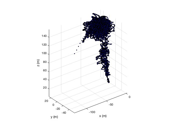
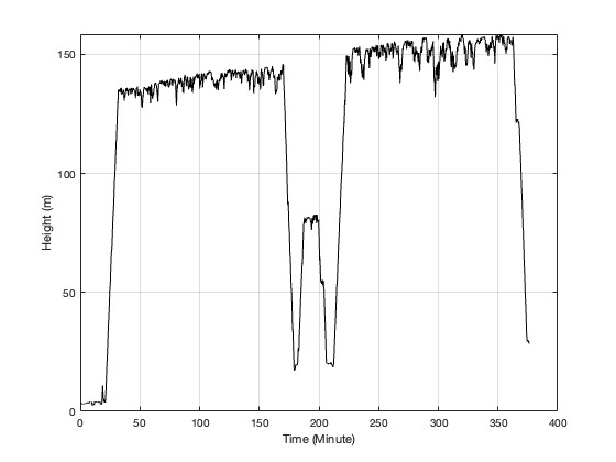
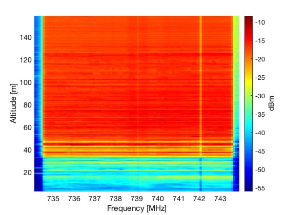
We conducted a spectrum monitoring experiment using a helikite in an urban environment during NC State’s Packapalooza festival in August 2025. The helikite was equipped with a software-defined radio (SDR) and global positioning system (GPS) receivers and flown for approximately 6 hours, starting around noon. The helikite reached an altitude of approximately 160 meters at its peak. The spectrum was continuously swept up to 6 GHz, with each sweep taking about 15 seconds.
Representative Results
The Helikite’s trajectory, altitude during the experiment, and spectrum monitoring results are presented below.
Potential use cases for this dataset include:
- Enhancing Spectrum Management
- Environmental and Geographical Analysis of Spectrum
- Spectrum Occupancy Modeling at all sub-6 GHz Bands