
Dataset-21: UAV Ray Tracing Simulations with 5 Towers at Lake Wheeler
Lead Experimenter
Donggu Lee, North Carolina State University
Link to Dataset
- Dataset Link:
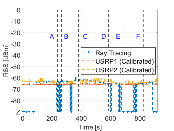
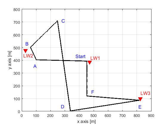
This dataset contains received signal strength (RSS) simulation results generated using NVIDIA Sionna’s ray tracing engine. For verification, real-world RSS measurements from a UAV-based campaign are included (see [Dataset-12] ). Ray tracing simulations were conducted at the same location as the measurements, using corresponding GPS trajectories. The dataset can be accessed here [Dryad].
Publications Using This Dataset
- A. H. F. Raouf, D. Lee, M. Rahman, S. Masrur, G. Reddy, C. Dickerson, M. S. Hossen, S. Vargas Villar, A. Gürses, S. Singh, S. J. Maeng, M. Ezuma, C. Roberts, M. R. Sarbudeen, T. J. Zajkowski, M. Mushi, O. Ozdemir, R. Asokan, I. Guvenc, M. L. Sichitiu, R. Dutta, “Curated Wireless Datasets for Aerial Networks Research,” Nature npj Wireless Technology, June 2026.
- D. Lee, O. Ozdemir, A. Ram, I. Guvenc, “Analysis and Prediction of Coverage and Channel Rank for UAV Networks in Rural Scenarios with Foliage,” IEEE Open J. Veh. Technol, February 2025.
- William Bjorndahl, “The Wireless Channel as a Radiance Field,” PhD Dissertation, May 2026.
- D. Lee, “Ray Tracing-Based MIMO Link Analysis and Performance Evaluation of Asymmetric Links for UAV Networks,” PhD Dissertation, January 2026.
Equipment and Software Used
Sionna, Python, MATLAB
Description
This dataset contains Sionna-based ray tracing simulation results for UAV communication. In this experiment, an unmanned aerial vehicle acts as the transmitter, while five towers in the Lake Wheeler area serve as receivers.
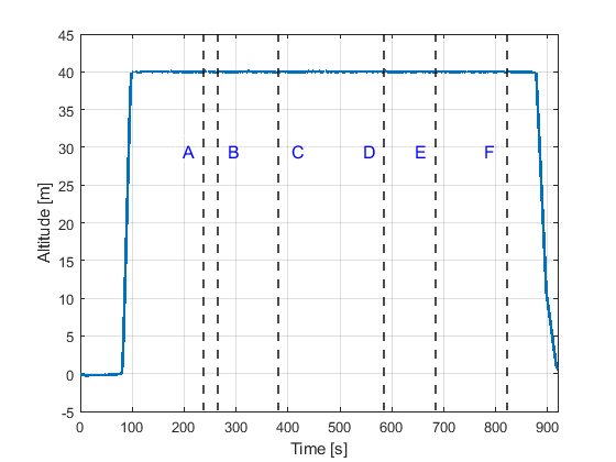
Each tower uses a dual-channel USRP (B210) to measure received signal strength. Ray tracing was performed over the UAV’s predefined flight trajectory, using matching transmitter and receiver configurations.
MATLAB scripts for plotting the trajectory, altitude over time, and for comparing simulation and measurement results are included.
Representative Results
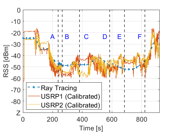
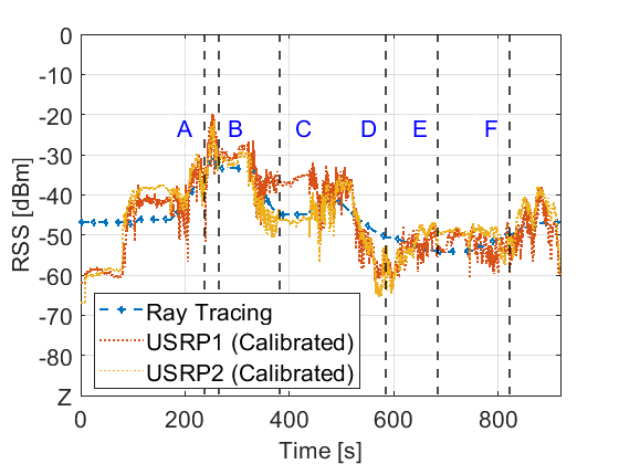
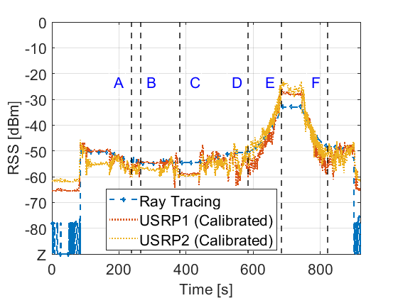
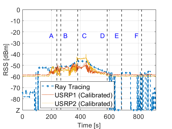
The RSS results for LW-1 to LW-5, along with the altitude versus time data from this experiment, are presented below.
Potential use cases for this dataset include:
- RF Coverage Analysis and Planning
- Performance Benchmarking
- Network Management for UAV Applications